wUSS Helena at Pearl Harbor
7 December 1941

The Attack
Page 1


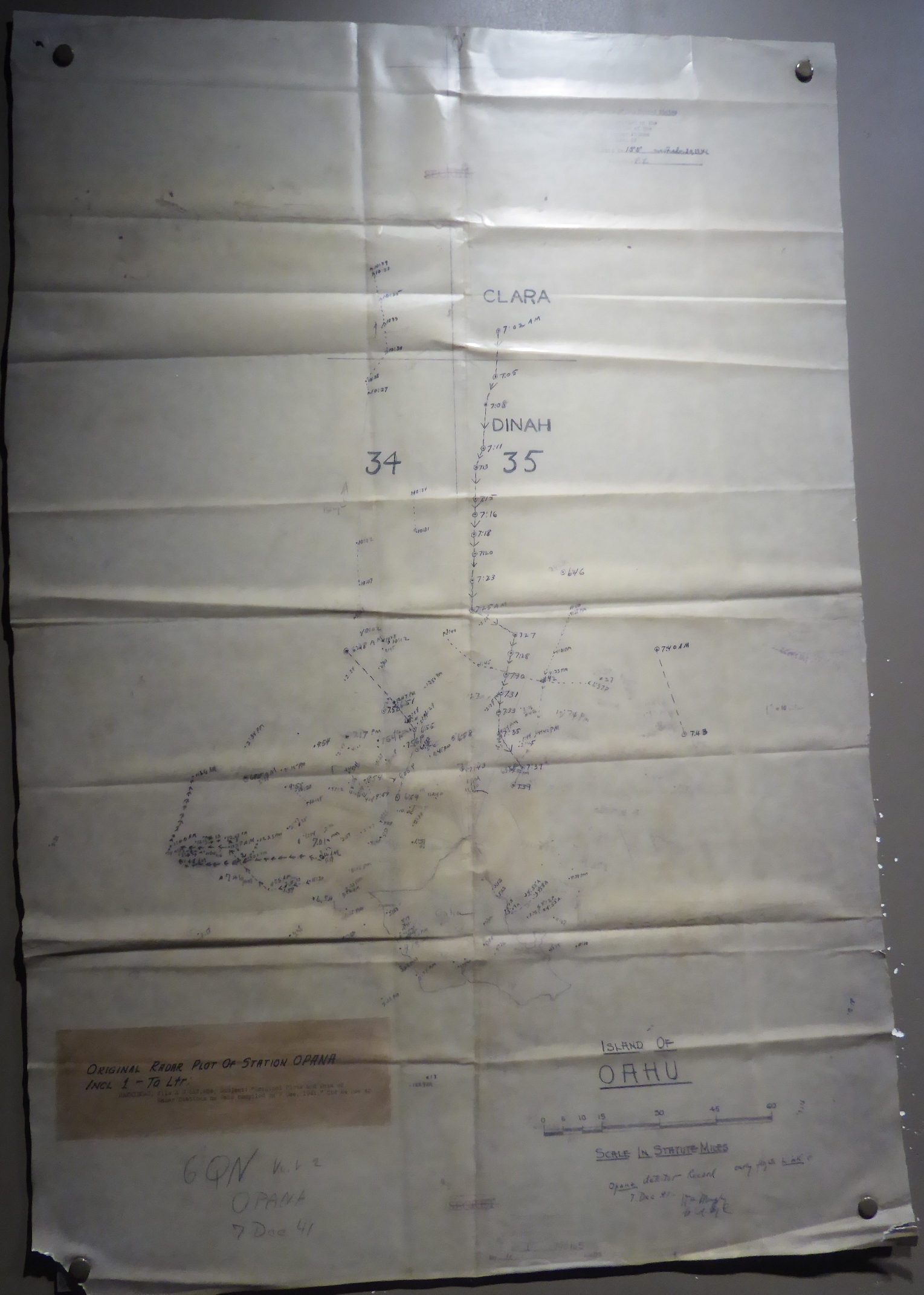
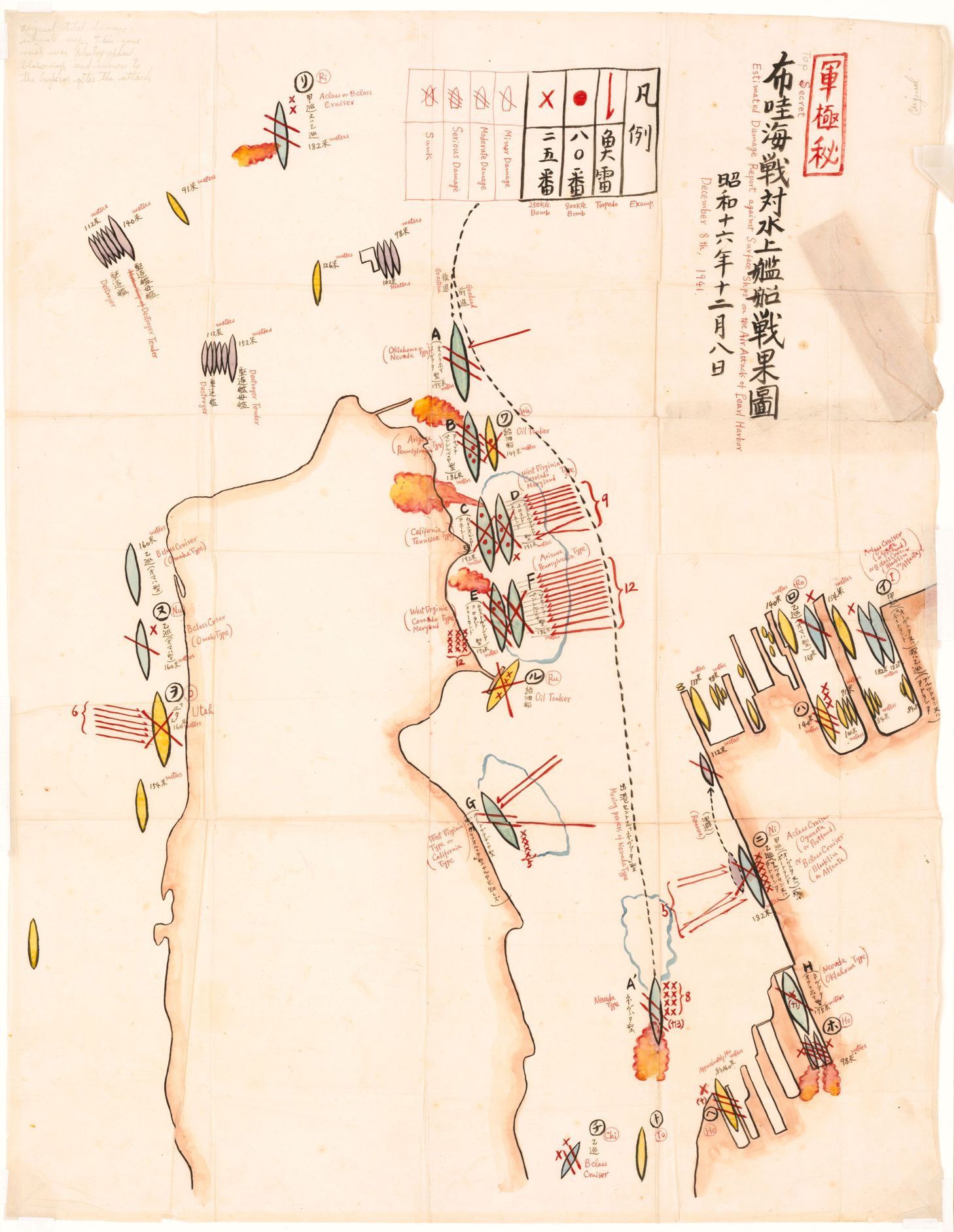
The two images in this page are quite large to allow details to be clearly shown.

The first is the Opana Radar Plot
and

the second is a Japanese map drawn by
Lt Commander Mitsuo Fuchida,
Commander of all Air Groups

More information about this map is at the
Library of Congress
web site.

Formal Title:

Estimated Damage Report Against Surface Ships on
The Air Attack of Pearl Harbor on December 8th, 1941


Maps and aerial photos in the

Orientation Section

may be of assistance with the layout of Pearl Harbor

Commentary begins on
Page 2


ORIGINAL OPANA RADAR PLOT

source: Exhibit Gallery : Attack
Pearl Harbor Visitor Center

BACK TO TOP

JAPANESE MAP OF THE ATTACK
DRAWN BY LT COMMANDER MICHIDO FUCHIDA

HELENA IS AT LOWER RIGHT
AT 1010 DOCK
WITH 6 X WHERE BOMBS DROPPED
AND 5 ARROWS FOR TORPEDOES

source: Library of Congress

BACK TO TOP